Orbital Precision. Earthly Clarity.
SEE EARTH FROM ABOVE.
DOWN TO THE LAST DETAIL.
Resolution so sharp, you can count the trees — from orbit.
Resolution so sharp, you can count the trees — from orbit.
From a pin drop on a map to a zoomable ultra-HD satellite image — in under 48 hours.
Drop a pin or send us Co-ordinates.
A satellite pass is scheduled within 48 hours. Our LEO constellation locks onto your coordinates.
Receive your ultra-HD imagery with our zoomable viewer. Download in GeoTIFF or JPEG.
Every feature engineered for professionals who need Earth's truth — uncompromised.
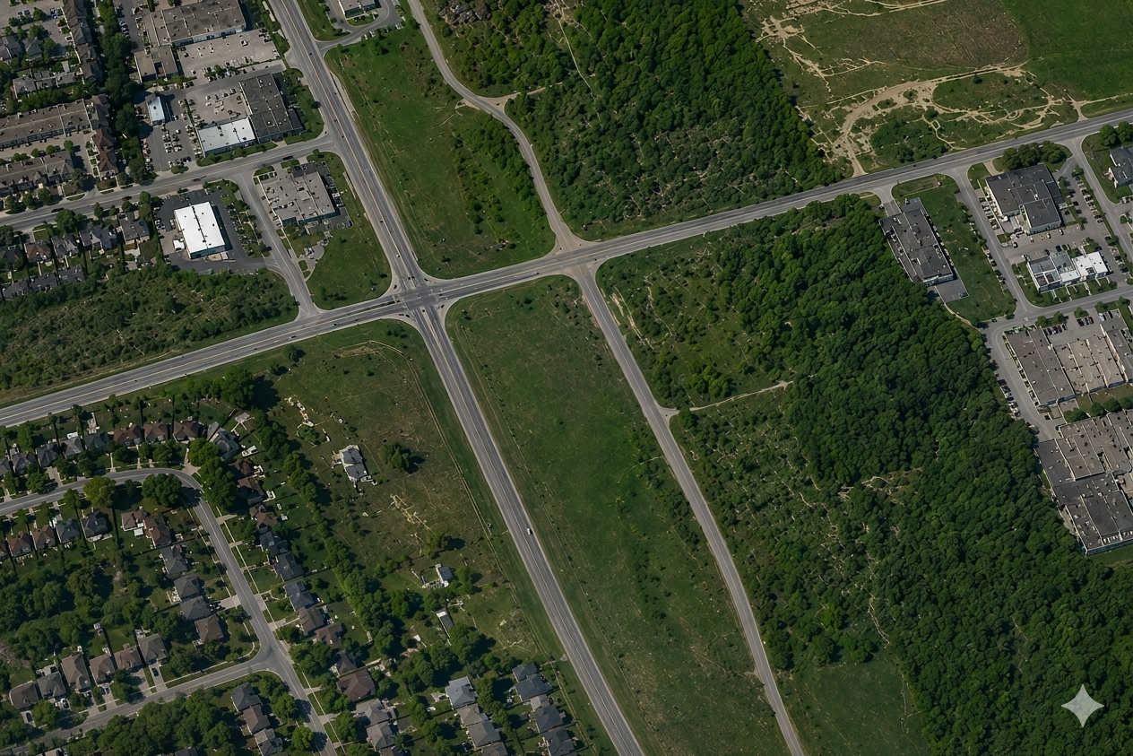
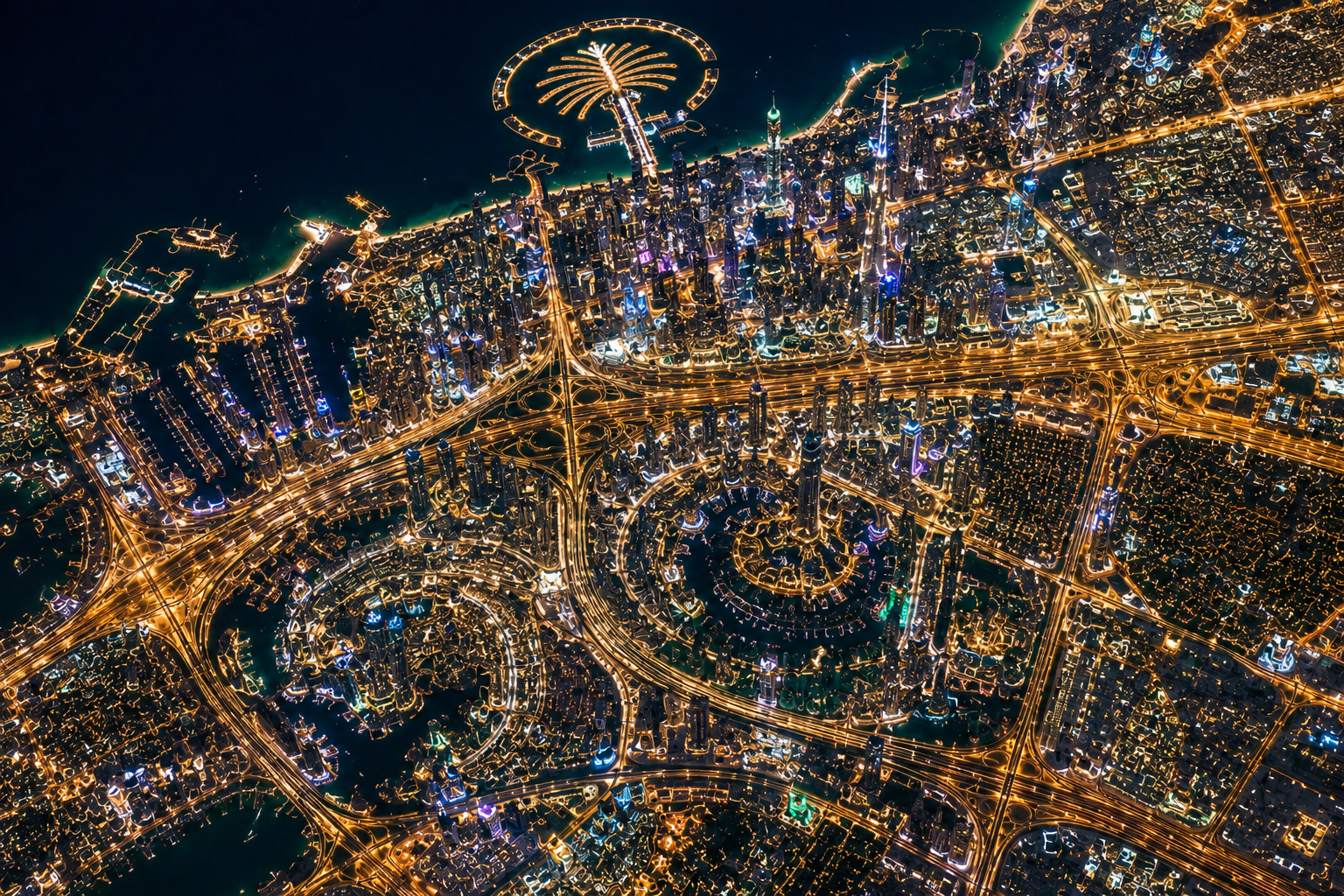
Sub-meter accuracy down to 30cm GSD. See rooftops, vehicles, crop rows — all with crystalline clarity.
Each image covers an entire city district in one shot. No stitching, no seams — just vast seamless coverage.
Pyramid-tiled imagery allows infinite zoom from regional overview to street-level detail with zero degradation.
Georeferenced outputs compatible with QGIS, ArcGIS, Google Earth Engine, and every major GIS platform.
Generate cinematic 30–90 second satellite-based videos for project monitoring, marketing campaigns, infrastructure updates, and visual storytelling.
RESTful API and Python SDK for automated ordering, delivery webhooks, and programmatic analysis pipelines.
Monitor infrastructure, environmental activity, urban growth, and major events using high-resolution satellite intelligence captured directly from orbit.
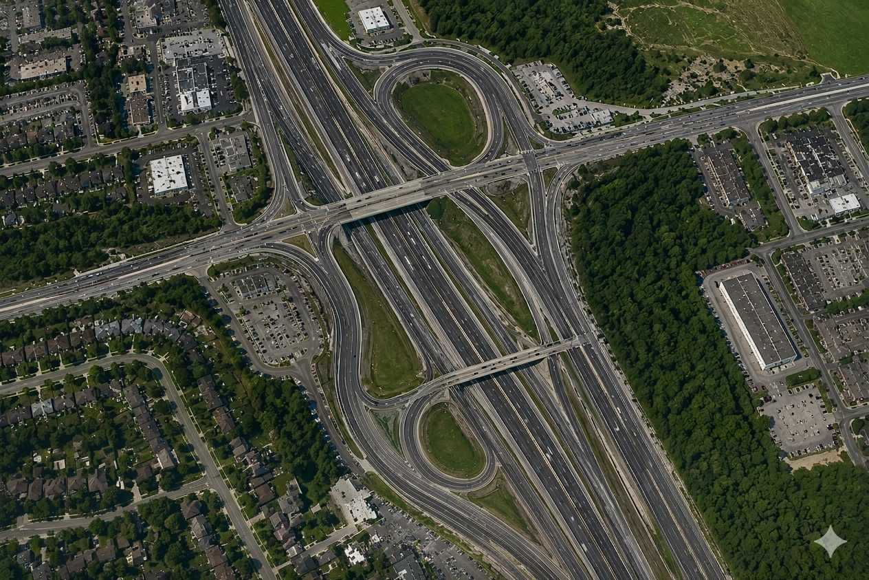
Infrastructure expansion detected over 6 months using orbital satellite intelligence.
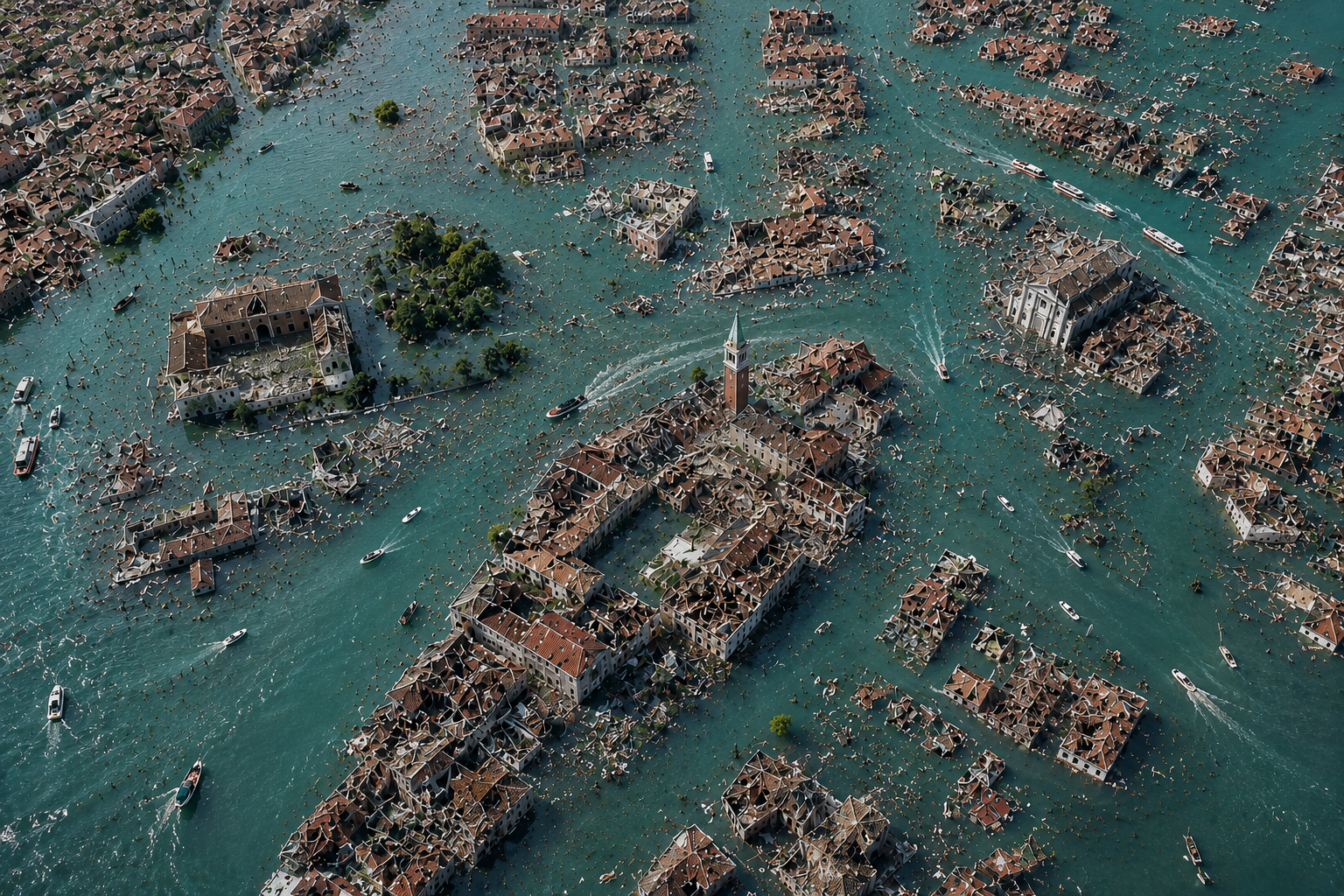
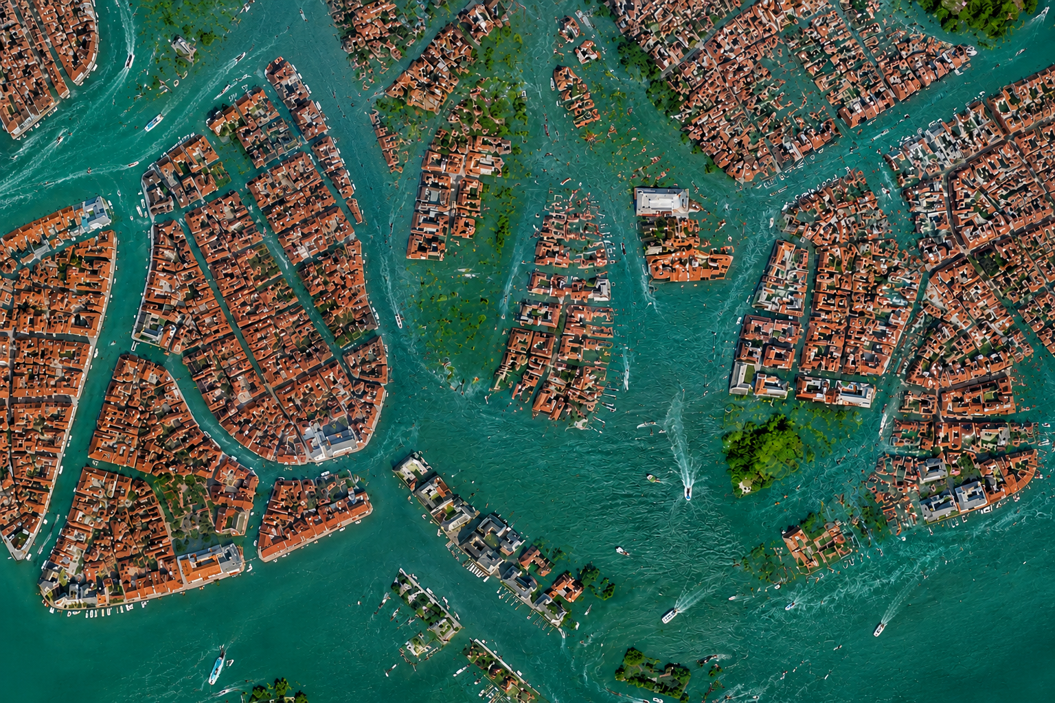
Satellite imagery identified flooded regions, water spread, and infrastructure impact after severe rainfall events.
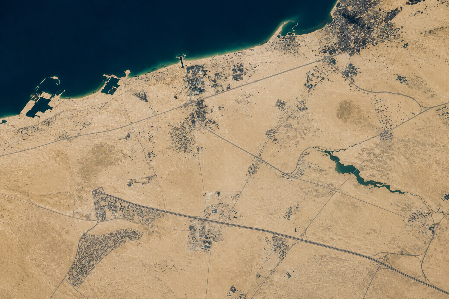
Analyze rapid city growth, land development, and new infrastructure projects over time.
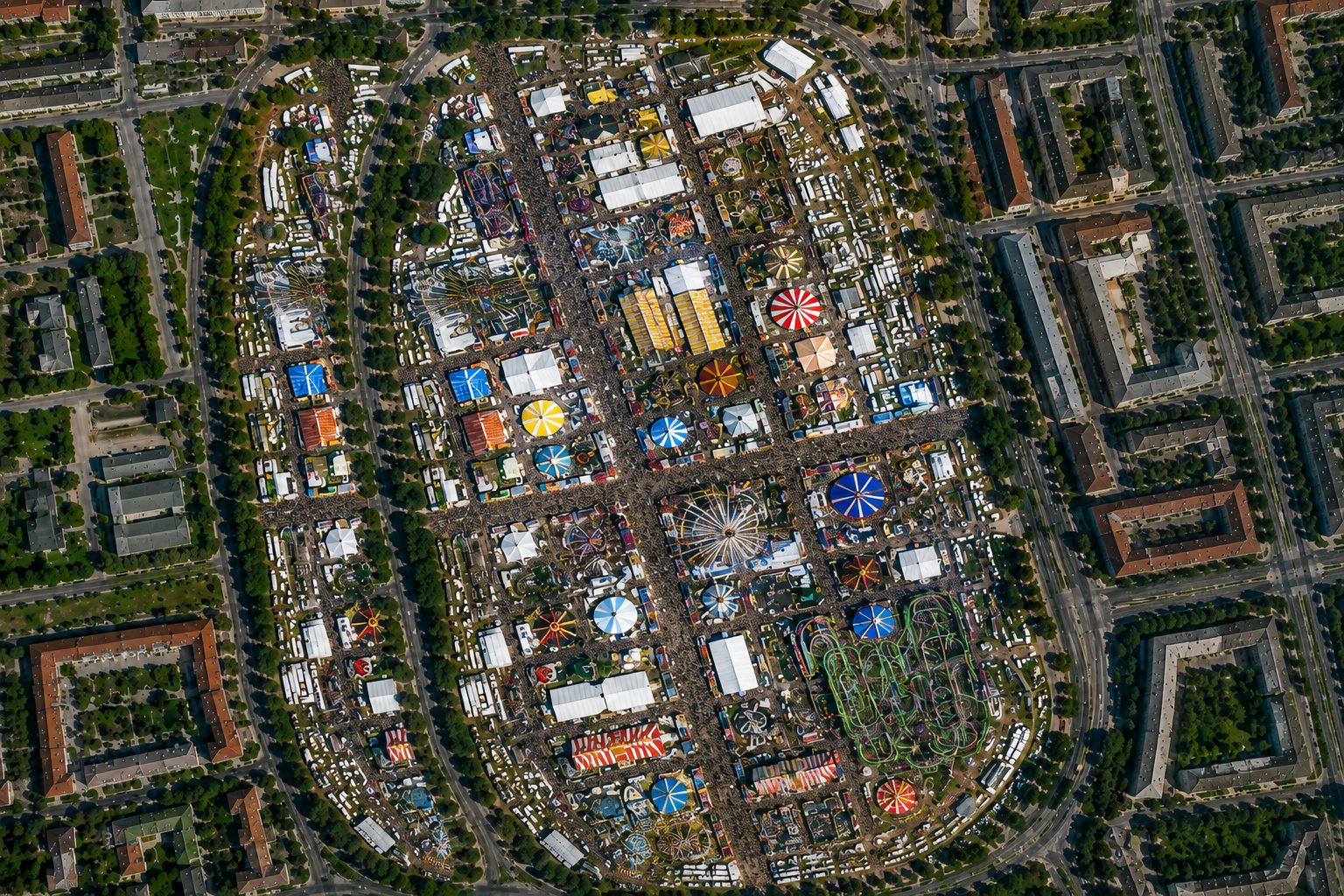
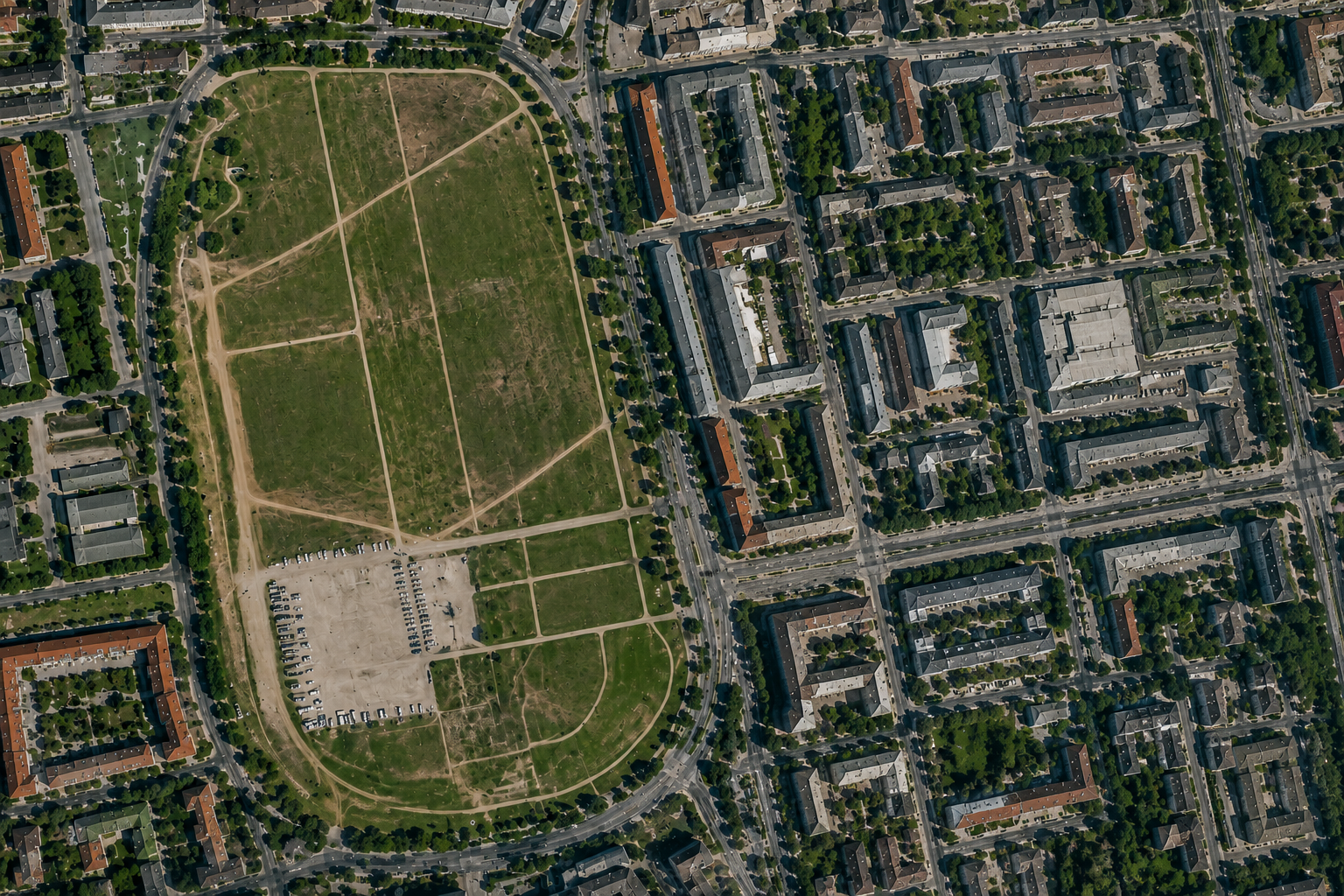
Compare imagery before and during large public events to identify crowd zones and temporary infrastructure.
From infrastructure monitoring to environmental analysis, STARFIE delivers high-resolution Earth intelligence across industries worldwide.
Support infrastructure planning, regional monitoring, emergency response, and geospatial intelligence operations.
Track construction progress, highway expansion, project timelines, and infrastructure development.
Monitor crop health, irrigation activity, land utilization, and seasonal agricultural changes.
Deliver premium satellite visuals for land analysis, development planning, and property intelligence.
Create cinematic satellite visuals for campaigns, documentaries, digital ads, and storytelling content.
Assess environmental impact, disaster zones, flood damage, and infrastructure risk analysis.
Observe mining activity, excavation expansion, operational zones, and environmental monitoring.
Detect floods, wildfires, infrastructure damage, and emergency conditions using satellite intelligence.
Analyze city growth, transportation networks, zoning expansion, and smart city development.
Designed for organizations that rely on high-resolution satellite intelligence, monitoring, and visual geospatial analysis.
Monitor highways, bridges, industrial sites, and construction progress from orbit with large-scale visual intelligence.
Create cinematic satellite visuals for campaigns, presentations, documentaries, and branded storytelling.
Analyze urban expansion, zoning activity, development patterns, and land-use transformation.
Detect floods, environmental impact, and infrastructure damage using before-and-after analysis.
Access worldwide satellite imagery and monitoring capabilities across remote and urban regions.
High-resolution delivery formats, scalable workflows, and geospatial-ready visual intelligence systems.
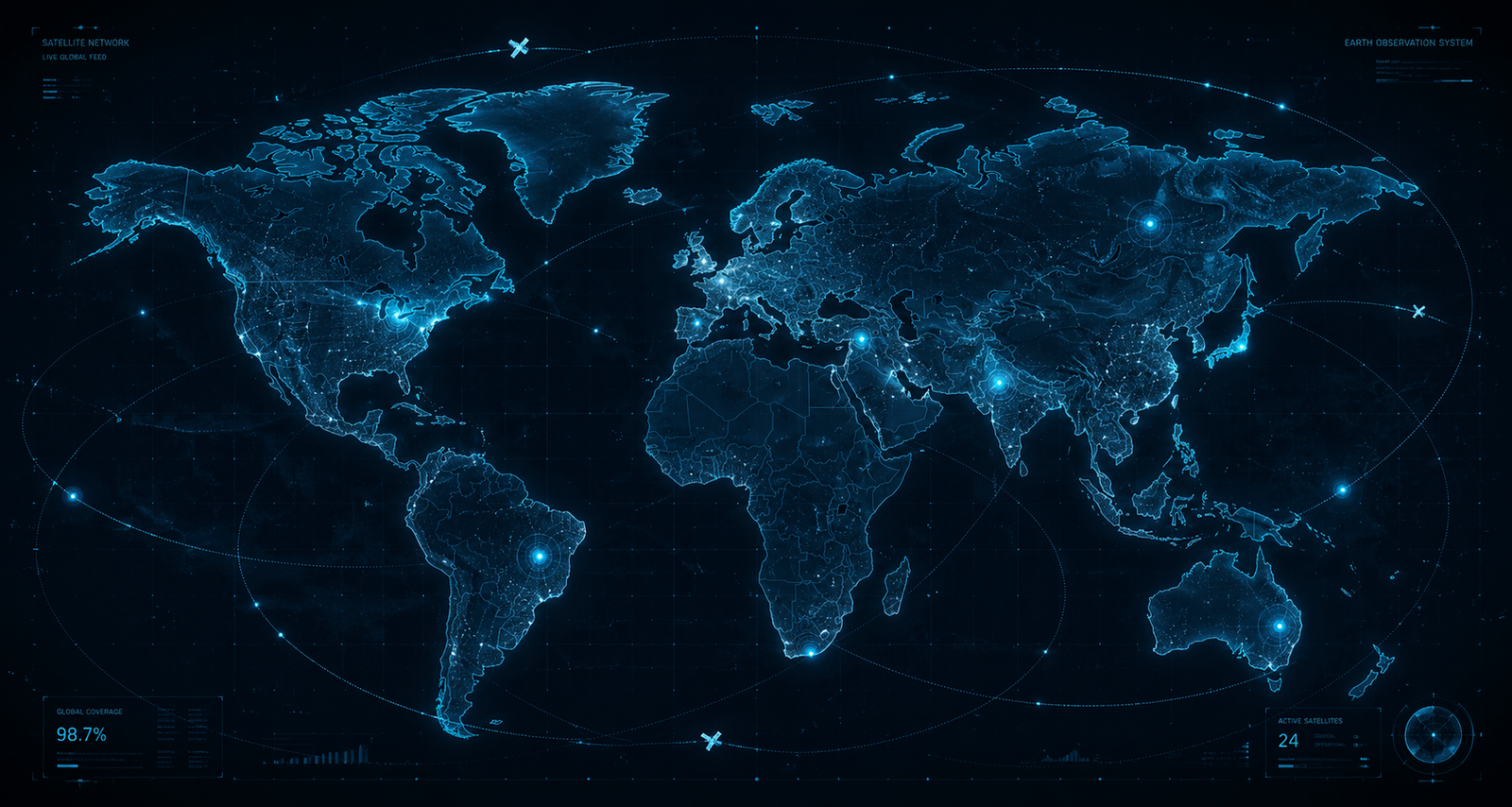
Monitor active satellite coverage, recent captures, and orbital intelligence across major regions worldwide.
Explore cinematic orbital flyovers, infrastructure monitoring, and advanced before-and-after satellite analysis captured from orbit.
Experience Earth from orbit with cinematic flyovers and large-scale satellite observation visuals.
Monitor highways, buildings, and infrastructure projects with time-based satellite intelligence.
Visualize environmental, urban, and event-based changes through advanced image comparison transitions.
Detect infrastructure activity, environmental changes, object movement, and land transformation using AI-assisted satellite intelligence from orbit.
Identify land, infrastructure, and environmental changes using before-and-after satellite comparison analysis.
Detect vehicles, structures, equipment, ships, and activity zones from high-resolution imagery.
Analyze terrain, vegetation, urban regions, water bodies, and infrastructure categories.
Evaluate disaster impact, flood zones, wildfire spread, and infrastructure damage rapidly.
Estimate traffic density, parking utilization, and event activity using orbital imagery analysis.
Track infrastructure development, project expansion, and construction timelines from space.
Everything you need to know about satellite imagery, delivery timelines, coverage, and capture capabilities.
Imagery freshness depends on satellite revisit schedules and weather conditions. Many regions can be captured within hours to a few days depending on orbital coverage and cloud conditions.
We support multiple resolutions ranging from sub-30cm ultra-HD imagery to wide-area monitoring captures for regional analysis and mapping.
Yes. You can request captures for custom coordinates, cities, infrastructure projects, construction sites, events, and remote areas globally.
Delivery time varies based on capture scheduling, weather conditions, and processing requirements. Standard delivery ranges from a few hours to 48 hours.
Yes. Historical satellite archives can be used for before-and-after analysis, urban expansion tracking, environmental monitoring, and long-term change detection.
Monitor how locations transform over time using high-resolution satellite imagery. Detect fairs, temporary events, urban activity, crowd movement, and infrastructure changes with visual comparison intelligence.

Identify temporary events like fairs, expos, festivals, and public gatherings from satellite imagery in near real-time.
Compare historical and latest captures of the same location to highlight activity, construction, or environmental changes.
Gain visual insights for urban planning, crowd analysis, tourism, event management, and infrastructure monitoring.
Receive processed comparison visuals quickly with ready-to-use marketing and reporting formats.
Whether you need a single image or an enterprise orbital pipeline, our team is ready to launch. Transmit your coordinates and we'll respond within 24 hours.
hello@STARFIE.com
sales@STARFIE.com
Within 24 hours, Mon – Fri
docs.STARFIE.com
Your message has been transmitted to our team.
We'll respond within 24 hours.